![](/images/other/stat-length.png)
![Excursión Senderismo La Bosse - La Bosse - Photo](https://media.geolcdn.com/t/1900/400/d07c0f6d-620b-4f21-a95d-9a118e6e07a3.jpg&format=pjpeg&maxdim=2)
La Bosse
eltonnermou
Usuario
![Longitud](/images/other/stat-length.png)
![Altitud máxima](https://static1.geolcdn.com/siteimages/upload/files/1508320355ic_sort_altitude_max_24dp.png)
![Desnivel positivo](https://static1.geolcdn.com/siteimages/upload/files/1508320355ic_sort_den_pos_24dp.png)
![Km-Effort](/images/other/stat-length.png)
![Altitud mínima](https://static1.geolcdn.com/siteimages/upload/files/1508320355ic_sort_altitude_min_24dp.png)
![Desnivel negativo](https://static1.geolcdn.com/siteimages/upload/files/1508320355ic_sort_den_neg_24dp.png)
![Boucle](https://static1.geolcdn.com/siteimages/upload/files/16400158638029165_repeat_loop_refresh_sync_direction_icon.png)
![Senderismo](https://static1.geolcdn.com/sitytour/trail-icons/101.png)
3h25
Dificultad : Medio
![Escanee este código QR para abrir la excursión en la aplicación SityTrail](https://capi.geolives.com/qq0zvz2zws4bq2lad0pu/sitytour/trails/4105548/qr.png?size=200)
Aplicación GPS de excursión GRATIS
A propósito
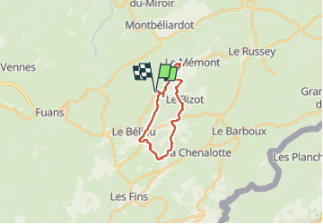
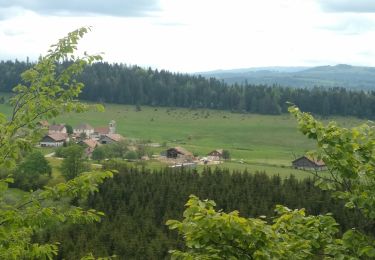
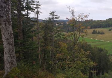
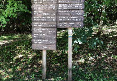
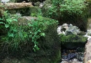
Ruta Senderismo de 17,1 km a descubrir en Borgoña-Franco Condado, Doubs, La Bosse. Esta ruta ha sido propuesta por eltonnermou.
Descripción
le départ est préferable depuis le Bélieu avec un parking près de l'église (plus de places) au lieu de La Bosse. Depuis le Bélieu rejoindre le tracé par ce chemin qui descend et partir à gauche comme le tracé vous y invite.
A partir des ruines du château le cheminement se fait sur des lapiaz pendant env 2km = les bâtons sont fortement conseillés afin d'éviter des chutes et/ou entorses.
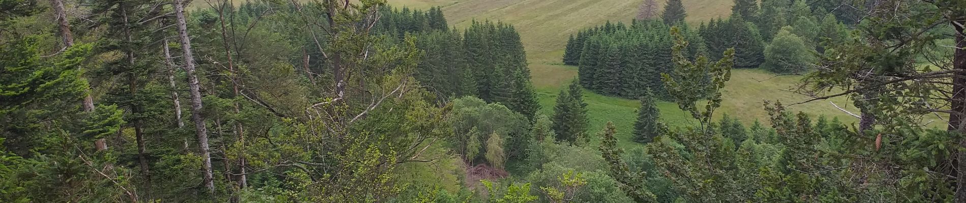
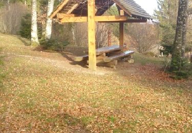
très belle randonnée essentiellement en de magnifiques sous bois, avec des beaux points de vue ; des passages en montée un peu plus engageants (bâtons fortement conseillés).
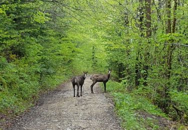
Et comme dans de tels paysages, laissez vous surprendre, comme moi par des chamois et un écureuil , par la faune et la flore, sans toutefois la cueillir.
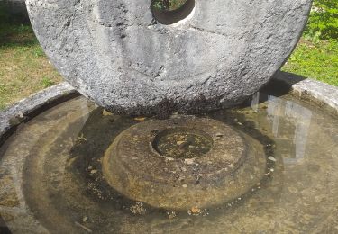
Localización
Comentarios
Excursiones cerca
![Excursión Senderismo Consolation-Maisonnettes - petite Consolation - Photo](https://media.geolcdn.com/t/375/260/662e8c39-79b2-4baa-8523-d8b7f3256288.jpg&format=jpg&maxdim=2)
![Senderismo Senderismo](https://static1.geolcdn.com/sitytour/trail-icons/101.png)
Senderismo
![](/images/other/stat-length.png)
![](https://static1.geolcdn.com/siteimages/upload/files/16400158638029165_repeat_loop_refresh_sync_direction_icon.png)
![Excursión Senderismo Consolation-Maisonnettes - Côte de Consolation - Photo](https://media.geolcdn.com/t/375/260/66d6ea63-33da-465e-9e77-fe9e8297d216.jpg&format=jpg&maxdim=2)
![Senderismo Senderismo](https://static1.geolcdn.com/sitytour/trail-icons/101.png)
Senderismo
![](/images/other/stat-length.png)
![](https://static1.geolcdn.com/siteimages/upload/files/16400158638029165_repeat_loop_refresh_sync_direction_icon.png)
![Excursión Senderismo Consolation-Maisonnettes - consolation Roche du prêtre - Photo](https://media.geolcdn.com/t/375/260/b3ba44ec-dd2d-4b07-a3a7-9924b2bc4faa.jpg&format=jpg&maxdim=2)
![Senderismo Senderismo](https://static1.geolcdn.com/sitytour/trail-icons/101.png)
Senderismo
![](/images/other/stat-length.png)
![](https://static1.geolcdn.com/siteimages/upload/files/16400158638029165_repeat_loop_refresh_sync_direction_icon.png)
![Excursión Senderismo Noël-Cerneux - Noel Cerneux 3 juin 2021 (IBP74 ) CAF - Photo](https://media.geolcdn.com/t/375/260/80618379-1714-4179-a397-1753a6a6b6d6.jpg&format=jpg&maxdim=2)
![Senderismo Senderismo](https://static1.geolcdn.com/sitytour/trail-icons/101.png)
Senderismo
![](/images/other/stat-length.png)
![](https://static1.geolcdn.com/siteimages/upload/files/16400158638029165_repeat_loop_refresh_sync_direction_icon.png)
![Excursión Senderismo Consolation-Maisonnettes - Cirque de la Consolation - cascade du Lancot - Photo](https://media.geolcdn.com/t/375/260/95b8c88c-b39b-418d-8455-f0fcfb781015.jpg&format=jpg&maxdim=2)
![Senderismo Senderismo](https://static1.geolcdn.com/sitytour/trail-icons/101.png)
Senderismo
![](/images/other/stat-length.png)
![](https://static1.geolcdn.com/siteimages/upload/files/16400158638029165_repeat_loop_refresh_sync_direction_icon.png)
![Excursión Senderismo Le Bizot - Le Bizot - Photo](https://media.geolcdn.com/t/375/260/ea582bfe-94a0-4ec5-9e15-673224c845ef.jpg&format=jpg&maxdim=2)
![Senderismo Senderismo](https://static1.geolcdn.com/sitytour/trail-icons/101.png)
Senderismo
![](/images/other/stat-length.png)
![](https://static1.geolcdn.com/siteimages/upload/files/16400158638029165_repeat_loop_refresh_sync_direction_icon.png)
![Excursión Senderismo Consolation-Maisonnettes - Cirque de consolation avec Marc - Photo](https://media.geolcdn.com/t/375/260/43f88b26-0204-42aa-9fb8-cea2c1fedf26.jpg&format=jpg&maxdim=2)
![Senderismo Senderismo](https://static1.geolcdn.com/sitytour/trail-icons/101.png)
Senderismo
![](/images/other/stat-length.png)
![](https://static1.geolcdn.com/siteimages/upload/files/16400158638029165_repeat_loop_refresh_sync_direction_icon.png)
![Excursión Senderismo Consolation-Maisonnettes - Du Séminaire de Consolation à la Roche des Prêtres - Photo](https://media.geolcdn.com/t/375/260/ext.jpg?maxdim=2&url=https%3A%2F%2Fservices.sitytrail.com%2FGeolivesWS%2FDownloadMedia.ashx%3FTrailID%3D425111%26Media%3Dfix__20150524133216.jpg)
![Senderismo Senderismo](https://static1.geolcdn.com/sitytour/trail-icons/101.png)
Senderismo
![](/images/other/stat-length.png)
![](https://static1.geolcdn.com/siteimages/upload/files/16400158638029165_repeat_loop_refresh_sync_direction_icon.png)
![Excursión Senderismo Montbéliardot - arboretum - Photo](https://media.geolcdn.com/t/375/260/ext.jpg?maxdim=2&url=https%3A%2F%2Fservices.sitytrail.com%2FGeolivesWS%2FDownloadMedia.ashx%3FTrailID%3D258623%26Media%3Dfix__20140319164154.jpg)
![Senderismo Senderismo](https://static1.geolcdn.com/sitytour/trail-icons/101.png)
Senderismo
![](/images/other/stat-length.png)
![](https://static1.geolcdn.com/siteimages/upload/files/16400158638029165_repeat_loop_refresh_sync_direction_icon.png)